Crust (geology)
The outermost solid shell of a planet or satellite.

User:Zakapedia · CC BY-SA 3.0
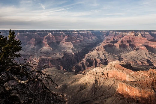
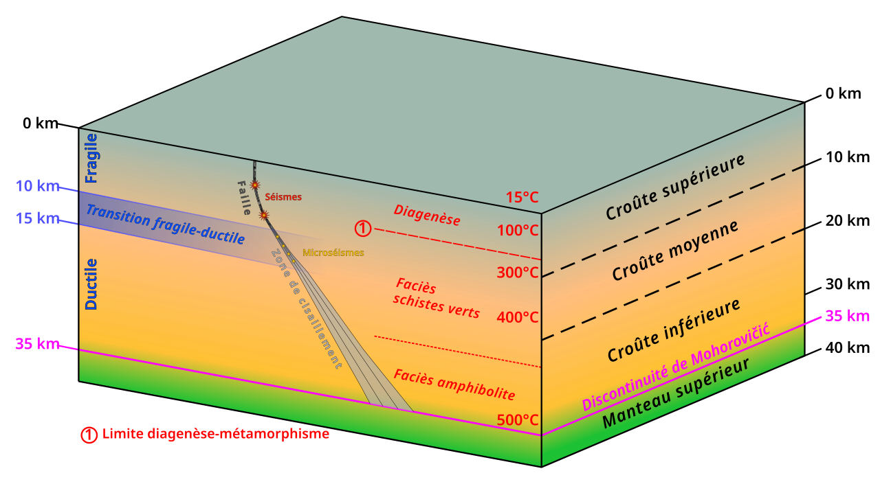
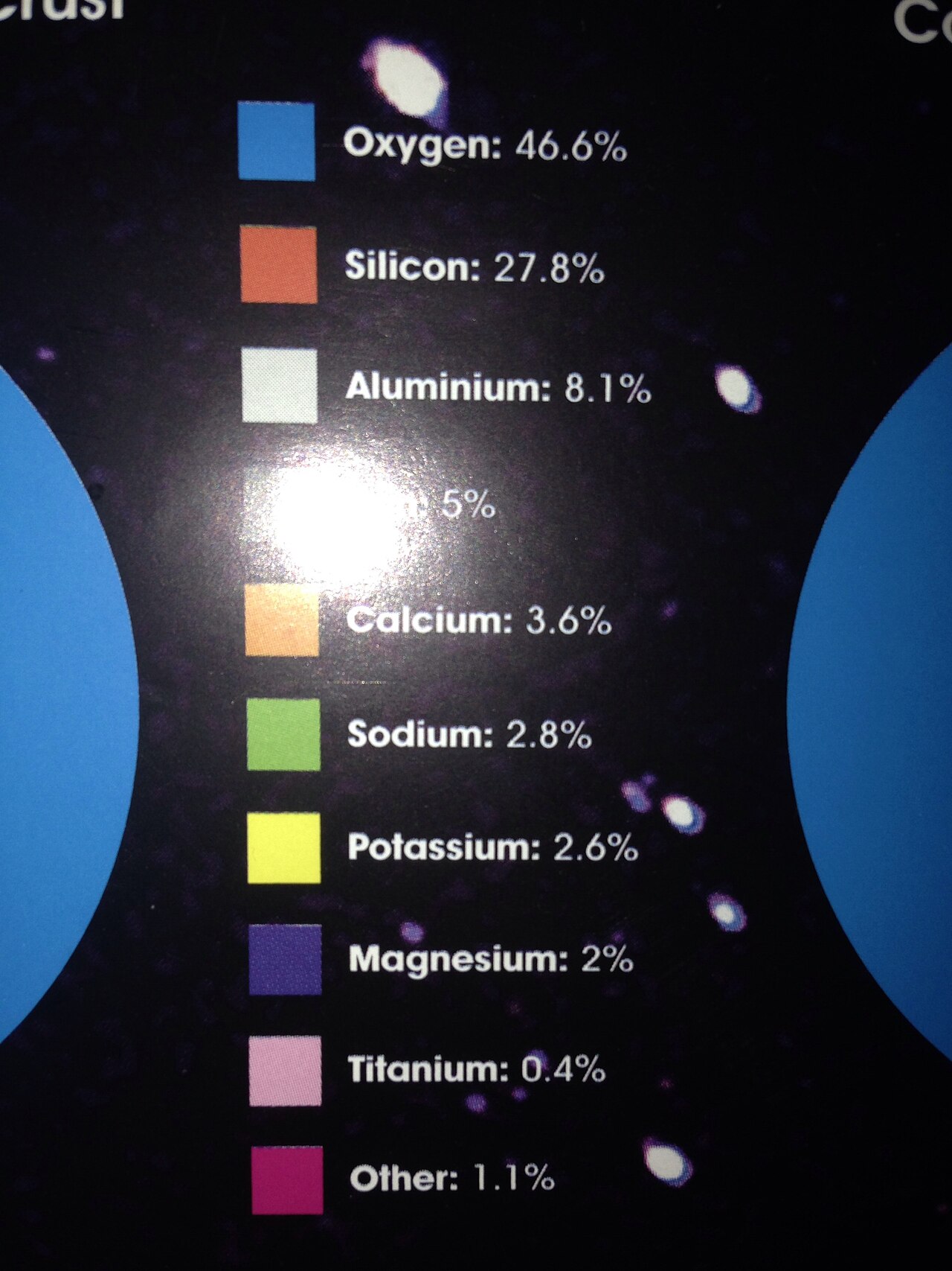
In geology, the crust is the outermost solid shell of a planet, dwarf planet, or natural satellite. It is usually distinguished from the underlying mantle by its chemical makeup, though in icy satellites it may be defined by phase. Crusts form via igneous processes and are modified by erosion, impact cratering, volcanism, and sedimentation. Earth has two distinct types—continental and oceanic—while most other terrestrial planets have fairly uniform crusts.
Lore & Background
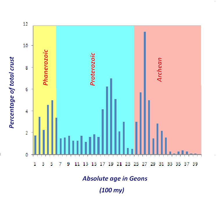
Planetary geologists divide crust into three categories based on how and when it formed. Primary crust, or primordial crust, is a planet's original crust formed from solidification of a magma ocean. None of Earth's primary crust has survived due to erosion and plate tectonics, but the Moon's anorthosite highlands are primary crust, formed as plagioclase crystallized and floated to the top. Mercury's highlands may represent primary crust, though this is debated. On Mars, the ancient highlands are thought to be possible primary crust, but the Martian meteorite ALH84001 is not considered a sample of primary crust. Venus may retain some primary crust in its tesserae, which are ancient and possibly primordial, though extensive resurfacing has obscured much of it.
Reader's Guide
Secondary crust is the most common type in the Solar System, formed by partial melting of mantle silicates, usually basaltic. Most surfaces of Mercury, Venus, Earth, and Mars comprise secondary crust, as do the lunar maria. On Earth, secondary crust forms primarily at mid-ocean spreading centers. Tertiary crust is more chemically modified and can form via igneous processes or erosion and sedimentation. The only known example is Earth's continental crust, likely requiring plate tectonics, which Earth alone in the Solar System possesses. Earth's crust accounts for less than 1% of Earth's volume and is part of the lithosphere, broken into tectonic plates.
Did You Know?
- Earth has two distinct types of crust: continental and oceanic, formed by different geological processes.
- The Moon's primary crust formed as plagioclase crystallized from a magma ocean and floated to the surface.
- Tertiary crust is only known on Earth, likely because plate tectonics is needed to create it.
- The lunar crust averages about 50 to 60 km thick, significantly thicker than Earth's crust relative to size.
The Principles That Order Deep Time
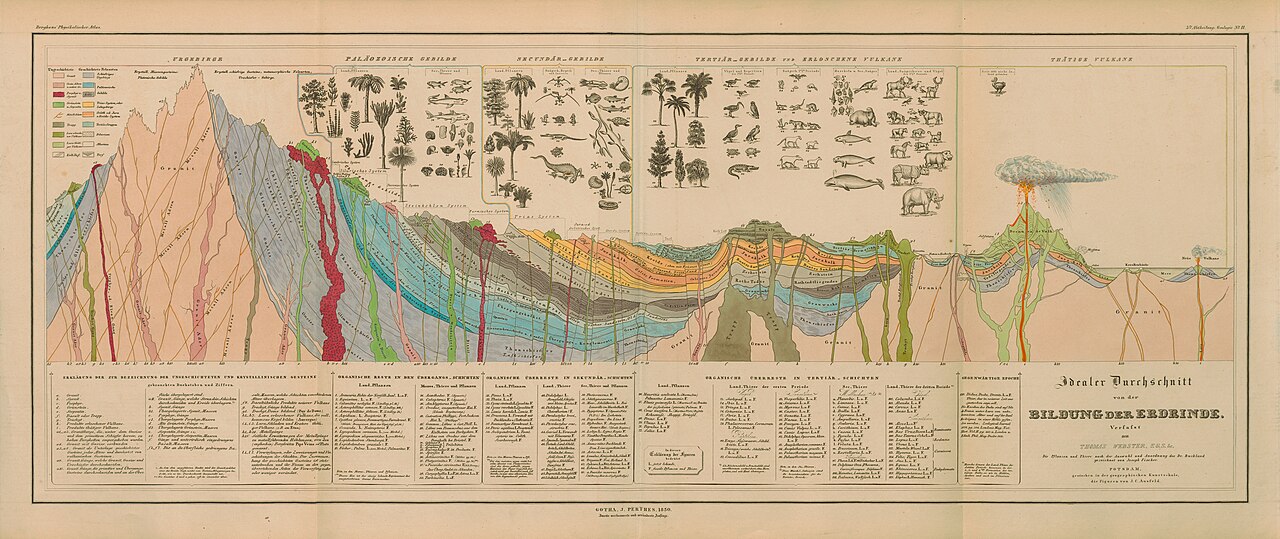
Chronostratigraphy organizes the rocks of Earth's crust into groups known as chronostratigraphic units, each encompassing all rock sequences deposited globally during a particular time interval. The discipline rests on a suite of foundational principles that allow geologists to determine relative relationships among strata. The law of superposition holds that in undeformed sequences, the oldest layers sit at the bottom while newer material accumulates above. Original horizontality notes that sediments initially settle under gravity, though modern understanding acknowledges exceptions. Lateral continuity recognizes that layers extend in all directions until they thin out or are truncated by a different rock, with their limits governed by basin geometry and available sediment. Cross-cutting relationships dictate that a rock cutting through another must be younger. The law of included fragments states that embedded rock pieces predate the host. Unconformities, representing gaps from erosion or non-deposition, reveal relative timing. Finally, faunal succession observes that distinctive fossil assemblages succeed one another in a reliable vertical order, enabling correlation even where the horizon is discontinuous.
Pinning Down Absolute Ages
Geochronology supplies the quantitative backbone that complements chronostratigraphy's relative ordering. It employs geochronometric techniques such as radiometric dating to assign precise numerical ages to rock materials, while also drawing on relative methods like paleomagnetism and stable isotope ratios to establish timeframes for events in Earth's history. A geochronologic unit represents the interval of time during which a corresponding chronostratigraphic unit was deposited; for instance, all rocks of the Silurian System formed during the Silurian Period. A critical distinction is that while absolute ages can be refined as dating technology improves, the physical rock boundary defining the chronostratigraphic unit remains fixed. In early 2022, the base of the Cambrian Period was adjusted from 541 million years to 538.8 million years, yet the rock-based boundary between the Ediacaran and Cambrian systems, anchored at its Global Boundary Stratotype Section and Point, was left untouched. Only the numerical age shifted; the stratigraphic definition held steady.
The Golden Spikes of Global Correlation
Before the International Commission on Stratigraphy worked to harmonize conflicting regional terminology, geologists around the world used different names for time-equivalent rocks due to lithological and biostratigraphic variation. The GSSP system resolved this by anchoring the lower boundary of each stage to a single, precisely identified point within a specific rock succession at a particular geographic location. These reference points, colloquially called golden spikes, create a binary division: every bed above the spike belongs to one time interval, and every bed below it to another. This mechanism allows geologists to correlate strata of similar age across the globe with the section containing the spike. A striking example is the iridium anomaly deposited by the Chicxulub asteroid impact, which marks the base of the Paleogene System and the Cretaceous–Paleogene boundary. Although the formal GSSP sits at Oued Djerfane in Tunisia, the iridium signature is detectable in rock layers worldwide, making the correlation universally applicable.
Building a Universal Language for Earth Science
The geologic time scale spans approximately 4.54 plus or minus 0.05 billion years, encompassing the full arc of Earth's history. It is not the product of a single discipline but a synthesis of chronostratigraphy and geochronology, drawing on lithologies, paleomagnetic properties, and fossil assemblages to identify fundamental changes in the rock record that correspond to major geological or paleontological events. The International Commission on Stratigraphy, operating as a constituent body of the International Union of Geological Sciences, bears the primary responsibility for defining the standardized international units that populate the International Chronostratigraphic Chart. These chronostratigraphic divisions in turn anchor the geochronologic units used to describe time. The scale serves a broad community of Earth scientists—geologists, paleontologists, geophysicists, geochemists, and paleoclimatologists—who rely on it to articulate the timing and relationships of events across deep time.
Gallery
Frequently Asked Questions
Who is Crust (geology)?
The crust is the outermost solid shell of a planet, dwarf planet, or natural satellite. It is set apart from the mantle below by its distinct chemical composition, though on icy moons the boundary may instead be defined by a phase change.
What are Crust (geology)'s powers/role?
The crust originates through igneous processes and is subsequently reshaped by erosion, impact cratering, volcanism, and sedimentation. On Earth it divides into two distinct types—continental and oceanic—whereas most other rocky bodies carry a single, more uniform crust.
How does Crust (geology)'s story end?
There is no fixed finale; the crust is perpetually cycled, broken down by weathering and subduction, then rebuilt as new rock through volcanic and tectonic activity. Its narrative is an ongoing loop of destruction and reformation rather than a single concluding event.
Why is Crust (geology) important?
It is the only part of a planet's interior that hosts surface processes such as erosion, sedimentation, and, on Earth, life. Because it preserves layered rock records, the crust serves as the primary archive geologists consult to reconstruct a body's history.
More in Geology 1-24
Elsewhere in the Geology universe
Spotted an error? Know more?
This is a living reference — every entry is fact-audited, and reader corrections feed straight into our audit queue. Suggest an edit · See this site's audit record